Πέμπτη 24 Σεπτεμβρίου 2020

Starets Silouane un moine du Mont-Athos: D'après la biographie du Père Sophrony (French) Album // The Life of st Silouan the Athonite in comic book


amazon.com

J'ai trouvé ce livre par hasard parce que le prénom de ma petite fille peut -être souhaité le jour de la Saint Silouane le 24 septembre
Ce starets Silouane né en en 1866 et décédé en 1938 a été canonisé en 1987 par l'église orthodoxe russe, simple moine, merveilleux moine "rempli de douceur" écrira Nicolas Vélimirolitch.. Les illustrations de Gaëtan Evrad faites à partir de documents de monastères sont magnifiques, très douces dans leurs coloris et formes;
C'est son histoire racontée en BD Il vit dans une famille pauvre paysanne mais croyante. Il a 4 frères et 2 sœurs et à l'âge de 4 ans lors de la visite d'un marchand il dit" quand je serai grand, j'irai chercher Dieu par toute la terre". Le temps passe il oublie cette parole. Il vit comme beaucoup, il est fort, un jour où il a un peu trop bu il se bat violemment. Un jour il fit un étrange rêve, il a entendu la voix de Marie.
Il changea de vie, il appris que Dieu pouvait pardonné même à un meurtrier ( il venait d'en rencontré un qui avait été pardonné par Dieu de son crime). Devenir moine lui revint en force. Il fit six années de service militaire . Il fut très estimé pendant son service militaire...je vous laisse découvrir la suite... IL a été canonisé en 1987 et présenté comme docteur apostolitique et prophétique de l'eglise et du peuple chrétien. 

In England

Voir aussi

Saint Siluan of Mount Athos - Three wonderful publications in Swahili, Kikuyu and Masai...


Σάββατο 19 Σεπτεμβρίου 2020

Περιοδικό "Εξωτερική Ιεραποστολη", τεύχος 250, παρηγοριά & αγωνία από τον Ευαγγελισμό της Οικουμένης! // The new summer issue of the Orthodox Mission magazine.


Αδελφότητα Ορθοδόξου Εξωτερικής Ιεραποστολής

Με τη χάρη του Θεού, το τριμηνιαίο περιοδικό μας “Εξωτερική Ιεραποστολή” συμπληρώνει 250 τεύχη απρόσκοπτης και συνεχούς κυκλοφορίας.

Στο νέο τεύχος Σεπτεμβρίου μπορείτε να διαβάσετε νέα και ανταποκρίσεις από 12 ιεραποστολικά κλιμάκια.

  • Πώς ξεκίνησε η Ιεραποστολή μεταξύ των Μαορί της Νέας Ζηλανδίας;
  • Τι έκανε η Ιεραποστολή μας στο Ναϊρόμπι για να βοηθήσει τον κόσμο κατά τη διάρκεια του lockdown λόγω της πανδημίας;
  • Ποιες είναι οι προοπτικές ανάπτυξης της Ορθόδοξης Ιεραποστολής στην Μπουρκίνα Φάσο;
  • Ποιος είναι ο νέος επίσκοπος Κισούμου, επί κεφαλής της Ιεραποστολής μας στα ανατολικά της λίμνης Βικτωρίας;
  • Ποιος ο νέος ιεραποστολικός αγρός του Ερμόλαου Ιατρού στην Τανζανία;

Αυτά και άλλα πολλά στο τεύχος που έχετε στις οθόνες σας. Ξεφυλλίστε το, διαβάστε το, διαδώστε το.

Σας προσκαλούμε να το διαβάσετε δωρεάν εδώ


The new summer issue of the Orthodox Mission magazine is out with news and reports from 14 missionary regions in Africa, Asia and the Pacific.

  • Why is the Tongan Orthodox mission looking for a priest?
  • How do our missions in Africa and Indonesia experience the COVID-19 pandemic?
  • How did the Ugandan Orthodox church celebrate its centennial?
  • What finally happened to the sick boy who was hospitalized in Toliara?
  • New Orthodox Parish in Burkina Faso.

These and many more in the issue at hand. Read it online. Share it with your friends.

You can read it free here:

ierapostoli.wordpress.com

https://orthodoxmission.org.gr/

See also


Τρίτη 15 Σεπτεμβρίου 2020

The Universal Exaltation of the Precious and Life-Giving Cross (September 14)

For the content of the Feast read here.

BELIEVERS DO NOT DIE BUT HAVE ETERNAL LIFE 

– Homily on Sunday before Exaltation of the Holy Cross
September 13, 2020 Ssengendo James Leave a comment
Uganda Orthodox Church

It is 22nd Lord’s Sunday from resurrection. But it falls in the week, when we shall have the exaltation of the Holy Cross. For the Precious Cross of our salvation is exalted on 14th September every year. Therefore, the readings of the 22nd Lord’s Sunday are kept aside, and instead of them we use the appointed readings of the Sunday Before the Exaltation of the Cross. Gal 6:11-16. Jn3:13-17.
Today, on the Sunday before the Exaltation of the Precious Cross, we learn in preparation about the meaning of the Cross in our life, as members of the salvation work of Christ, the Word and Son of God the Father, in the Holy Spirit. Compare the related passages, like: Mt 10:38; 16:24. Mk 8:34. Lk 9:23; 14:27. Jn 19:17. Ro 5:10. 1 Cor 1:18, 23 – 24. Col 1:20, 22. Nu 21:8-9.
When we gather all the above passages and internalize them, surly then we understand that, the modern Christians who reject the Cross from their life are totally wrong and heretical.
The teaching of Christ is very clear. “No one has ever gone into heaven (and returned) except the one who came from heaven – the Son of Man. Just as Moses lifted up the snake in the desert, so the Son of Man must be lifted up, that everyone who believes in Him may have eternal life”. Jn 3:13 -15. Nu 21: 8-9.

Uganda (here)

We must conceive the meaning of this passage in context of the entire chapter Jn 3. And we should not isolate the chapter (introducing the fact) from the whole Biblical teaching. In this chapter, besides baptism of recreation, Christ establishes the Cross also as the central mystery, for the kingdom of God to come on earth. Mt 4:17, 23; 6:10. He reconciles us (if we believe) to God the Father in the Holy Spirit, through His sacrifice on the Cross, death, burial and resurrection, after three days.
The teaching of Apostle Paul deepens the Cross in the life of Christians, according to the teaching of Christ himself. “May we never boast except in the Cross of our Lord Jesus Christ, through which the world has been crucified to us, and ourselves to the world”. Gal 6:14. This is meant not in exterior but interior (spiritual) activities of our recreation into new beings, as believers in eternal life. For believers in eternal life do not die spiritually, but participate in eternal life from here on earth.


Celebrating Sunday Before the Universal Exaltation of the Holy Cross in Sierra Leone

"When Christ lived as a man on the earth, similarly now too He is always close to us in order to lead us victoriously to the glory of the Resurrection, of the Kingdom of the Father and of the Son and Holy Spirit"

By His Eminence Archbishop Serafim Kykotis

Greek Orthodox Archbishopric of Zimbabwe

Today’s Gospel extract reminds us of an amazing event, which occurred 1500 years before Christ’s crucifixion. In point of fact, the book of Holy Scripture, Numbers, the 21, refers to the event where after the Israelite People were released by the Egyptians and though they had returned to their native country, in the desert where they found themselves, they began to complain strongly against Moses despite the fact that God in a miraculous way had fed them with “manna”. Their ingratitude and faithlessness however is punished immediately. Poisonous snakes scattered death everywhere. The desert where the ungrateful ones found themselves – the thankless and faithless Israelite – was transformed into a place of pain, anguish and death. The Jews then run to Moses in repentance and ask for help. They plead with him and entreat him to mediate on their behalf that God will take pity on them. Then God, as the Holy Scriptures tells us, orders Moses to make a copper snake and to raise it onto a tall stick in the midst of the people. In continuation, the Israelite People received the instruction that when a poisonous snake bit them, they should fix their sight on the copper snake and they would be saved.

And thus, it happened. The Israelite sight towards the copper snake neutralized the power of the poisonous snakes. Thus the Israelite People were saved.

Christ reminds us of this story, making it parallel to his ascent on the cross, so that whoever believes in Him will be saved. After this event from the Old Testament, the course of the redemptive work it outlined and stressed, which God’s offers to man through his only begotten Son, our Lord Jesus Christ. This is the reason besides that this event is referred to by Christ and especially the Sunday before the elevation of the Holy Cross, we are going to celebrate tomorrow.

From within this event, the Jews above all are distinguished who represent man, the snakes are identical to sin and the copper snake foreshadows the Cross of Christ.

It is well known from the first book of the Old Testament, the book of Genesis, that God has established man as the King and Lord of the whole of creation. He adorned him with logical intellect to think, to speak and to progress. However, instead of man declaring his boundless gratitude to his wise creator, he distanced himself. He infringed God’s commandment with the direct consequence of beginning to taste the bitter harvest of his demise. The original sin of the first created people, due to the unity of human nature, had abolishing consequences for the entire human race in the sense that now, every descendant of Adam and Eve, was born with the propensity and inclination to be attracted by evil, to take pleasure in wrongdoing and to live in sin. Here is the beginning of our ecological negative activities as humans destroying the holy whole Creation of God as a gift of God for the whole Humanity and for the future generations.

Tanzania (here)

In front of the exiled Paradise, there spreads a boundless and stormy sea which creates uncertainty, anguish, struggles, illnesses, misfortunes, troubles, sweat, pains and calamities without the possibility of deliverance existing – everywhere there is pain and death. From man’s life, orientation was missing, which would lead them to the harbor of salvation.

The few enlightened however were certainly not missing from God’s chosen people who constituted the means of communication between God and man. But even they were not listened to by the masses because every type of snake, the different transgressions had become the content of their life.

Just as the poison of the snakes brought about death to the Jews, so too sin brought about death to the human soul, it darkened and distorted man’s mind, it lightened his will, it dissolves the institution of the family, it waters people with glasses full of grief and bitterness, it dissolves every hope man has, thus becoming the captive of some passion. This was the wretched situation the people found themselves to be in my beloved before the coming of Christ to the world. But in this situation before Christ, continue to be those who live far from Christ – that is, all those who continue to be enslaved and bound to their passions, those who are without the intention of repentance and insist on living in the state of their sin. God’s boundless love dragged man away from the fall of death, from the anxiety of life, from sin, pain and misfortune. God offered deliverance to all the people. “For God so loved the world, that he gave his only begotten son, so that whoever believes in him does not perish but has eternal life”.

Thus today’s Gospel tells us that Christ came to the world and was crucified so that “whoever believes in him will not perish but will have eternal life.” This event as we have seen was first modeled in the Old Testament when Moses raised the copper snake and the Jews were saved from the poisonous snakes, when they looked upon it with faith. Thus, whoever believes and is united with Christ who was raised on the cross, is saved from death. He has eternal life Christ conquered death.

Contemporary society avoids speaking about death. It is afraid that it might perhaps create fearful emotions and oppressiveness in man. This stance however constitutes an error because under no circumstance does flight constitute a real solution. In opposition, Christian upbringing takes a stance where death is concerned. It speaks about it and it leads to victory in opposition to it. Death connects man with Christ-and it makes him through God’s grace, Immortal.

 Kenya (here)

Finally, the drama of death is clearly a human drama, which is only solved when man is united to the incarnate Christ. Then there is no death, because death for man who lives in Christ constitutes a crossing, which leads him to immortality: “Christ has risen from the dead, by death trampling upon Death, and has bestowed life to those in the tombs.

Christ’s death made eternal life a gift for us. Man’s salvation was realized upon the cross at Golgotha. Christ’s sacrifice delivered humanity. It offered an authentic situation, all the values that uplift man to the sphere of God’s Kingdom, truth, love, freedom, peace and furthermore he gave to every man the power to reach Godliness and to become equal to God through grace.

Two thousand years have passed my beloved, from the time when the cross was raised at Golgotha. Man however has not utilized the possibilities, which God offered him. He scorned this Godly love. He refused to implement the truth, which Christ brought to the world. He drove himself to a new distance. Instead of reaching godliness, traveling the road of grace, he reached the godliness of material things, following the road of perfecting himself. Man of our age set himself up as an idol and he became enslaved to his passions. On the matter of material progress and economic prosperity he has the inclination to sacrifice everything, even his soul. Thus contemporary man, despite his technological achievements and his material conquests feels restless and tired. His stomach is full but his soul is empty. He sees that destruction is advancing and he makes no effort to stop it. Disillusioned by everyone and everything, he has allowed every possibility of resistance to become paralyzed within himself and he had believed that everything for him now has become lost. This is the tragic mistake of contemporary man - his despair and his indifference.

We must never forget that then when Christ lived as a man on the earth, similarly now too He is always close to us in order to lead us victoriously to the glory of the Resurrection, of the Kingdom of the Father and of the Son and Holy Spirit. God gave us everything. He gave and he gives everything abundantly to the good and the evil. He sends His goods to the just and unjust He raises His sun on the sly and on the good. He loves friends and enemies. In the same manner, God wants us also to give. He wants us to give to our fellow human beings kindness, love, justice and humility. He wants us to give to others consolation, hope and joy. He wants us to give the good example of a Christian life. We must give way to rage, light to darkness, truth to lies, freedom to tyranny. He wants us to give like Him without calculations, without self-interest without violence. Each giving of this nature is also an ascent, a transformation, an orientation that leads to the Christian orientation of mankind. This is why the commandment of love towards every person is placed precisely after the commandment of our love towards God.

By omitting to give our love to our neighbors, we omit to declare our love to Christ.

However, under no circumstance should we upset the content of our love with the acceptance and supporting of erroneous and catastrophic views, but oppositely, with our resistance of these. The whip, which Christ used in the temple to drive away those who did not respect God, was an act of love.

"Official opening and blessings of our brand new beautiful kindergarten in Waterloo..." Sierra Leone

Σάββατο 12 Σεπτεμβρίου 2020

Libia. Torture nei campi di detenzione: le nuove immagini choc

diktiospartakos.blogspot.com

Katerina Tsapopoulou

Libia. Torture nei campi di detenzione: le nuove immagini choc
Paolo Lambruschi sabato 4 gennaio 2020
Donna appesa a testa in giù e presa a bastonate: le cronache dell'orrore dal lager di Bani Walid, in Libia. Sei morti in due mesi. Spuntano i nomi degli schiavisti: «Ci stuprano e ci uccidono»


Una giovane eritrea appesa a testa in giù urla mentre viene bastonata ripetutamente nella "black room", la sala delle torture presente nei centri di detenzione in Libia. Questa è una sequenza di frame del video choc spedito dai suoi aguzzini ai familiari della donna presa a bastonate allo scopo di estorcere soldi per salvare la figlia
 
COMMENTA E CONDIVIDI

Una giovane eritrea appesa a testa in giù urla mentre viene bastonata ripetutamente nella "black room", la sala delle torture presente in molti centri libici per migranti. Il video choc - di cui riportiamo solo alcuni fermo immagine - è stato spedito via smartphone ai familiari della sventurata che devono trovare i soldi per riscattarla e salvarle la vita.
È quello che accade a Bani Walid, centro di detenzione informale, in mano alle milizie libiche. Ma anche nei centri ufficiali di detenzione, dove i detenuti sono sotto la "protezione" delle autorità di Tripoli pagata dall’Ue e dall’Italia: la situazione sta precipitando con cibo scarso, nessuna assistenza medica, corruzione. In Libia l’Unhcr ha registrato 40mila rifugiati e richiedenti asilo, 6mila dei quali sono rinchiusi nel sistema formato dai 12 centri di detenzione ufficiali, il resto in centri come Bani Walid o in strada. In tutto, stima il "Global detention project", vi sarebbero 33 galere. Vi sono anche detenuti soprattutto africani non registrati la cui stima è impossibile.

La vita della ragazza del Corno d’Africa appesa, lo abbiamo scritto sette giorni fa, vale 12.500 dollari. Ma nessuno interviene e continuano le cronache dell’orrore da Bani Walid, unanimente considerato il più crudele luogo di tortura della Libia. Un altro detenuto eritreo è morto qui negli ultimi giorni per le torture inferte con bastone, coltello e scariche elettriche perché non poteva pagare. In tutto fanno sei morti in due mesi. Stavolta non siamo riusciti a conoscere le sue generalità e a dargli almeno dignità nella morte. Quando si apre la connessione con l’inferno vicino a noi, arrivano sullo smartphone con il ronzio di un messaggio foto disumane e disperate richieste di aiuto, parole di angoscia e terrore che in Italia e nella Ue abbiamo ignorato girando la testa o incolpando addirittura le vittime.

«Mangiamo un pane al giorno e uno alla sera, beviamo un bicchiere d’acqua sporca a testa. Non ci sono bagni», scrive uno di loro in un inglese stentato. «Fate in fretta, aiutateci, siamo allo stremo», prosegue. Il gruppo dei 66 prigionieri eritrei che da oltre due mesi è nelle mani dei trafficanti libici si è ridotto a 60 persone stipate nel gruppo di capannoni che formano il mega centro di detenzione in campagna nel quartiere di Tasni al Harbi, alla periferia della città della tribù dei Warfalla, situata nel distretto di Misurata, circa 150 chilometri a sud-est di Tripoli. Lager di proprietà dei trafficanti, inaccessibile all’Unhcr in un crocevia delle rotte migratorie da sud (Sebha) ed est (Kufra) per raggiungere la costa, dove quasi tutti i migranti in Libia si sono fermati e hanno pagato un riscatto per imbarcarsi. Lo conferma lo studio sulla politica economica dei centri di detenzione in Libia commissionato dall’Ue e condotto da "Global Initiative against transnational organized crime" con l’unico mezzo per ora disponibile, le testimonianze dei migranti arrivati in Europa.

I sequestratori, ci hanno più volte confermato i rifugiati di Eritrea democratica contattati per primi dai connazionali prigionieri, li hanno comperati dal trafficante eritreo Abuselam "Ferensawi", il francese, uno dei maggiori mercanti di carne umana in Libia oggi sparito probabilmente in Qatar per godersi i proventi dei suoi crimini. Bani Walid, in base alle testimonianze raccolte anche dall’avvocato italiano stanziato a Londra Giulia Tranchina, è un grande serbatoio di carne umana proveniente da ogni parte dell’Africa, dove i prigionieri vengono separati per nazionalità. Il prezzo del riscatto varia per provenienza e sta salendo in vista del conflitto. Gli africani del Corno valgono di più per i trafficanti perché somali ed eritrei hanno spesso parenti in occidente che sentono molto i vincoli familiari e pagano. Tre mesi fa, i prigionieri eritrei valevano 10mila dollari, oggi 2.500 dollari in più perché alla borsa della morte la quotazione di chi fugge e viene catturato o di chi prolunga la permanenza per insolvenza e viene più volte rivenduto, sale. Il pagamento va effettuato via money transfer in Sudan o in Egitto.

Dunque quello che accade in questo bazar di esseri umani è noto alle autorità libiche, ai governi europei e all’Unhcr. Ma nessuno può o vuole fare niente. Secondo le testimonianze di alcuni prigionieri addirittura i poliziotti libici in divisa entrano in alcune costruzioni a comprare detenuti africani per farli lavorare nei campi o nei cantieri come schiavi.
«Le otto ragazze che sono con noi – prosegue il messaggio inviato dall’inferno da uno dei 60 prigionieri eritrei – vengono picchiate e violentate. Noi non usciamo per lavorare. I carcerieri sono tre e sono libici. Il capo si chiama Hamza, l’altro si chiama Ashetaol e del terzo conosciamo solo il soprannome: Satana». Da altre testimonianze risulta che il boia sia in realtà egiziano e abbia anche un altro nome, Abdellah. Avrebbe assassinato molti detenuti.

Ma anche nei centri di detenzione pubblici in Libia, la situazione resta perlomeno difficile. Persino nel centro Gdf di Tripoli dell’Acnur per i migranti in fase di ricollocamento gestito dal Ministero dell’Interno libico e dal partner LibAid dove i migranti lasciati liberi da altri centri per le strade della capitale libica a dicembre hanno provato invano a chiedere cibo e rifugio. Il 31 dicembre l’Associated Press ha denunciato con un’inchiesta che almeno sette milioni di euro stanziati dall’Ue per la sicurezza, sono stati intascati dal capo di una milizia e vice direttore del dipartimento libico per il contrasto all’immigrazione. Si tratta di Mohammed Kachlaf, boss del famigerato Abd Al-Rahman Al-Milad detto Bija, che avrebbe accompagnato in Italia nel viaggio documentato da Nello Scavo su Avvenire. È finito sulla lista nera dei trafficanti del consiglio di sicurezza Onu che in effetti gli ha congelato i conti.

Ma non è servito a nulla. L’agenzia ha scoperto che metà dei dipendenti di LibAid sono prestanome a libro paga delle milizie e dei 50 dinari (35 dollari) al giorno stanziati dall’Unhcr per forniture di cibo a ciascun migrante, ne venivano spesi solamente 2 dinari mentre i pasti cucinati venìvano redistribuiti tra le guardie o immessi nel mercato nero. Secondo l’inchiesta i danari inoltre venivano erogati a società di subappalto libiche gestite dai miliziani con conti correnti in Tunisia, dove venivano cambiati in valuta locale e riciclati. Una email interna dell’agenzia delle Nazioni Unite rivela come tutti ne fossero al corrente, ma non potessero intervenire. L’Acnur ha detto di aver eliminato dal primo gennaio il sistema dei subappalti.

© RIPRODUZIONE RISERVATA

Παρασκευή 11 Σεπτεμβρίου 2020

The new summer issue of the Orthodox Mission magazine


The new summer issue of the Orthodox Mission magazine is out with news and reports from 14 missionary regions in Africa, Asia and the Pacific.

  • Why is the Tongan Orthodox mission looking for a priest?
  • How do our missions in Africa and Indonesia experience the COVID-19 pandemic?
  • How did the Ugandan Orthodox church celebrate its centennial?
  • What finally happened to the sick boy who was hospitalized in Toliara?
  • New Orthodox Parish in Burkina Faso.

These and many more in the issue at hand. Read it online. Share it with your friends.

You can read it free here:

ierapostoli.wordpress.com

https://orthodoxmission.org.gr/

Τετάρτη 9 Σεπτεμβρίου 2020

Zambezi


En.wikipedia
 
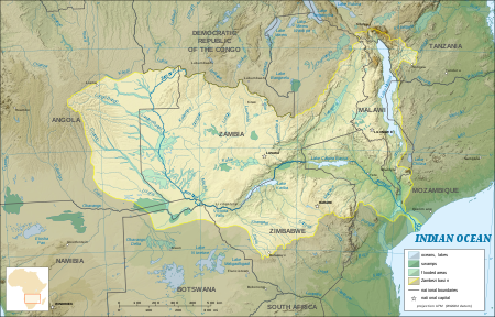
The Zambezi (also spelled Zambeze and Zambesi) is the fourth-longest river in Africa, the longest east-flowing river in Africa and the largest flowing into the Indian Ocean from Africa. The area of its basin is 1,390,000 square kilometres (540,000 sq mi),[1][2] slightly less than half of the Nile's. The 2,574-kilometre-long river (1,599 mi) arises in Zambia and flows through eastern Angola, along the north-eastern border of Namibia and the northern border of Botswana, then along the border between Zambia and Zimbabwe to Mozambique, where it crosses the country to empty into the Indian Ocean.
The Zambezi's most noted feature is Victoria Falls. Other notable falls include the Chavuma Falls at the border between Zambia and Angola, and Ngonye Falls, near Sioma in Western Zambia.
There are two main sources of hydroelectric power on the river, the Kariba Dam, which provides power to Zambia and Zimbabwe, and the Cahora Bassa Dam in Mozambique, which provides power to Mozambique and South Africa. There are additional two smaller power stations along the Zambezi River in Zambia, one at Victoria Falls and the other one near Kalene Hill in Ikelenge District.

The Zambezi and its river basin.

The river rises in a black marshy dambo in dense undulating miombo woodland 50 kilometres (31 mi) north of Mwinilunga and 20 kilometres (12 mi) south of Ikelenge in the Ikelenge District of North-Western Province, Zambia at about 1,524 metres (5,000 ft) above sea level.[3] The area around the source is a national monument, forest reserve and Important Bird Area.[4]
Eastward of the source, the watershed between the Congo and Zambezi basins is a well-marked belt of high ground, running nearly east-west and falling abruptly to the north and south. This distinctly cuts off the basin of the Lualaba (the main branch of the upper Congo) from that of the Zambezi. In the neighborhood of the source the watershed is not as clearly defined, but the two river systems do not connect.[5]
The region drained by the Zambezi is a vast broken-edged plateau 900–1200 m high, composed in the remote interior of metamorphic beds and fringed with the igneous rocks of the Victoria Falls. At Shupanga, on the lower Zambezi, thin strata of grey and yellow sandstones, with an occasional band of limestone, crop out on the bed of the river in the dry season, and these persist beyond Tete, where they are associated with extensive seams of coal. Coal is also found in the district just below Victoria Falls. Gold-bearing rocks occur in several places.

Upper Zambezi

The river flows to the southwest into Angola for about 240 kilometres (150 mi), then is joined by sizeable tributaries such as the Luena and the Chifumage flowing from highlands to the north-west.[5] It turns south and develops a floodplain, with extreme width variation between the dry and rainy seasons. It enters dense evergreen Cryptosepalum dry forest, though on its western side, Western Zambezian grasslands also occur. Where it re-enters Zambia it is nearly 400 metres (1,300 ft) wide in the rainy season and flows rapidly, with rapids ending in the Chavuma Falls, where the river flows through a rocky fissure. The river drops about 400 metres (1,300 ft) in elevation from its source at 1,500 metres (4,900 ft) to the Chavuma Falls at 1,100 metres (3,600 ft), in a distance of about 400 kilometres (250 mi). From this point to the Victoria Falls, the level of the basin is very uniform, dropping only by another 180 metres (590 ft) in a distance of around 800 kilometres (500 mi).
The first of its large tributaries to enter the Zambezi is the Kabompo River in the northwestern province of Zambia. A major advantage of the Kabompo River was irrigation. The savanna through which the river has flowed gives way to a wide floodplain, studded with Borassus fan palms. A little farther south is the confluence with the Lungwebungu River. This is the beginning of the Barotse Floodplain, the most notable feature of the upper Zambezi, but this northern part does not flood so much and includes islands of higher land in the middle.
 
Thirty kilometres below the confluence of the Lungwebungu the country becomes very flat, and the typical Barotse Floodplain landscape unfolds, with the flood reaching a width of 25 km in the rainy season. For more than 200 km downstream the annual flood cycle dominates the natural environment and human life, society and culture.
Eighty kilometres further down, the Luanginga, which with its tributaries drains a large area to the west, joins the Zambezi. A few kilometres higher up on the east the main stream is joined in the rainy season by overflow of the Luampa/Luena system.[5]
A short distance downstream of the confluence with the Luanginga is Lealui, one of the capitals of the Lozi people who populate the Zambian region of Barotseland in Western Province. The chief of the Lozi maintains one of his two compounds at Lealui; the other is at Limulunga, which is on high ground and serves as the capital during the rainy season. The annual move from Lealui to Limulunga is a major event, celebrated as one of Zambia's best known festivals, the Kuomboka.
After Lealui, the river turns to south-south-east. From the east it continues to receive numerous small streams, but on the west is without major tributaries for 240 km. Before this, the Ngonye Falls and subsequent rapids interrupt navigation. South of Ngonye Falls, the river briefly borders Namibia's Caprivi Strip.[5] The strip projects from the main body of Namibia, and results from the colonial era: it was added to German South-West Africa expressly to give Germany access to the Zambezi.
Below the junction of the Cuando River and the Zambezi the river bends almost due east. Here, the river is broad and shallow, and flows slowly, but as it flows eastward towards the border of the great central plateau of Africa it reaches a chasm into which the Victoria Falls plunge.

Middle Zambezi

Victoria Falls, the end of the upper Zambezi and beginning of the middle Zambezi

The Victoria Falls are considered the boundary between the upper and middle Zambezi. Below them the river continues to flow due east for about 200 kilometres (120 mi), cutting through perpendicular walls of basalt 20 to 60 metres (66 to 200 ft) apart in hills 200 to 250 metres (660 to 820 ft) high. The river flows swiftly through the Batoka Gorge, the current being continually interrupted by reefs. It has been described as one of the world's most spectacular whitewater trips, a tremendous challenge for kayakers and rafters alike. Beyond the gorge are a succession of rapids which end 240 km (150 mi) below Victoria Falls. Over this distance, the river drops 250 metres (820 ft).
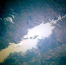
At this point, the river enters Lake Kariba, created in 1959 following the completion of the Kariba Dam. The lake is one of the largest man-made lakes in the world, and the hydroelectric power-generating facilities at the dam provide electricity to much of Zambia and Zimbabwe.
The Luangwa and the Kafue are the two largest left-hand tributaries of the Zambezi. The Kafue joins the main river in a quiet deep stream about 180 metres (590 ft) wide. From this point the northward bend of the Zambezi is checked and the stream continues due east. At the confluence of the Luangwa (15°37' S) it enters Mozambique.
The middle Zambezi ends where the river enters Lake Cahora Bassa (also spelled Cabora Bassa). Formerly the site of dangerous rapids known as Kebrabassa, the lake was created in 1974 by the construction of the Cahora Bassa Dam.

Lower Zambezi

The lower Zambezi's 650 km from Cahora Bassa to the Indian Ocean is navigable, although the river is shallow in many places during the dry season. This shallowness arises as the river enters a broad valley and spreads out over a large area. Only at one point, the Lupata Gorge, 320 km from its mouth, is the river confined between high hills. Here it is scarcely 200 m wide. Elsewhere it is from 5 to 8 km wide, flowing gently in many streams. The river bed is sandy, and the banks are low and reed-fringed. At places, however, and especially in the rainy season, the streams unite into one broad fast-flowing river.
About 160 km from the sea the Zambezi receives the drainage of Lake Malawi through the Shire River. On approaching the Indian Ocean, the river splits up into a delta.[5] Each of the four primary distributaries, Kongone, Luabo and Timbwe, is obstructed by a sand bar. A more northerly branch, called the Chinde mouth, has a minimum depth at low water of 2 m at the entrance and 4 m further in, and is the branch used for navigation. 100 km further north is a river called the Quelimane, after the town at its mouth. This stream, which is silting up, receives the overflow of the Zambezi in the rainy season.

Delta

The delta of the Zambezi is today about half as broad as it was before the construction of the Kariba and Cahora Bassa dams controlled the seasonal variations in the flow rate of the river.[citation needed]
Before the dams were built seasonal flooding of the Zambezi had quite a different impact on the ecosystems of the delta from today as it brought nutritious fresh water down to the Indian Ocean coastal wetlands. The lower Zambezi experienced a small flood surge early in the dry season as rain in the Gwembe catchment and north-eastern Zimbabwe rushed through while rain in the Upper Zambezi, Kafue, and Lake Malawi basins, and Luangwa to a lesser extent, is held back by swamps and floodplains. The discharge of these systems contributed to a much larger flood in March or April, with a mean monthly maximum for April of 6,700 cubic metres (240,000 cu ft) per second at the delta. The record flood was more than three times as big, 22,500 cubic metres (790,000 cu ft) per second being recorded in 1958. By contrast the discharge at the end of the dry season averaged just 500 cubic metres (18,000 cu ft) per second.[1]
In the 1960s and 1970s the building of dams changed that pattern completely. Downstream the mean monthly minimum–maximum was 500 cubic metres (18,000 cu ft) to 6,000 cubic metres (210,000 cu ft) per second; now it is 1,000 cubic metres (35,000 cu ft) to 3,900 cubic metres (140,000 cu ft) per second. Medium-level floods especially, of the kind to which the ecology of the lower Zambezi was adapted, happen less often and have a shorter duration. As with the Itezhi-Tezhi Dam's deleterious effects on the Kafue Flats, this has the following effects:

Ecology of the delta
Annotated view of the Zambezi river delta from space.[7]
 
NASA false-colour image of the upper Zambezi and Barotse (Balozi) floodplain during an extreme flood in 2003.

The Zambezi Delta has extensive seasonally- and permanently-flooded grasslands, savannas, and swamp forests. Together with the floodplains of the Buzi, Pungwe, and Save rivers, the Zambezi's floodplains make up the World Wildlife Fund's Zambezian coastal flooded savanna ecoregion in Mozambique. The flooded savannas lie close to the Indian Ocean coast. Mangroves fringe the delta's shoreline.
Although the dams have stemmed some of the annual flooding of the lower Zambezi and caused the area of floodplain to be greatly reduced they have not removed flooding completely. They cannot control extreme floods, they have only made medium-level floods less frequent. When heavy rain in the lower Zambezi combines with good runoff upstream, massive floods still happen and the wetlands are still an important habitat. However, as well as the shrinking of the wetlands further severe damage to wildlife was caused by uncontrolled hunting of animals such as buffalo and waterbuck during the Mozambique Civil War and now the conflict has ceased it is likely the floodplains will become more populated, and further damming has also been discussed. The only protected area of floodplain is the Marromeu Game Reserve near the city of Beira.[citation needed]
Although the region has seen a reduction in the populations of the large mammals, it is still home to some including the reedbuck and migrating eland. Carnivores found here include lion (Panthera leo), leopard (Panthera pardus), cheetah (Acinonyx jubatus), spotted hyena (Crocuta crocuta) and side-striped jackal (Canis adustus). The floodplains are a haven for migratory waterbirds including pintails, garganey, African openbill (Anastomus lamelligerus), saddle-billed stork (Ephippiorhynchus senegalensis), wattled crane (Bugeranus carunculatus), and great white pelican (Pelecanus onocrotalus).[8]
Reptiles include Nile crocodile (Crocodylus niloticus), Nile monitor lizard (Varanus niloticus) and African rock python (Python sebae), the endemic Pungwe worm snake (Leptotyphlops pungwensis) and three other snakes that are nearly endemic; floodplain water snake (Lycodonomorphus whytei obscuriventris), dwarf wolf snake (Lycophidion nanus) and swamp viper (Proatheris).[8]
There are a number of endemic butterflies. 


Climate

The north of the Zambezi basin has mean annual rainfall of 1100 to 1400 mm which declines towards the south, reaching about half that figure in the south-west. The rain falls in a 4-to-6-month summer rainy season when the Inter-Tropical Convergence Zone moves over the basin from the north between October and March. Evaporation rates are high (1600 mm-2300 mm) and much water is lost this way in swamps and floodplains, especially in the south-west of the basin.[9]

Wildlife

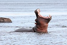
Hippopotamus in the Zambezi River
 
The river supports large populations of many animals. Hippopotamuses are abundant along most of the calm stretches of the river, as well as Nile crocodiles. Monitor lizards are found in many places. Birds are abundant, with species including heron, pelican, egret, lesser flamingo and African fish eagle present in large numbers. Riverine woodland also supports many large animals, such as buffalo, zebras, giraffes, elephants.
The Zambezi also supports several hundred species of fish, some of which are endemic to the river. Important species include cichlids which are fished heavily for food, as well as catfish, tigerfish, yellowfish and other large species. The bull shark is sometimes known as the Zambezi shark after the river, but is found around the world.

Tributaries

Upper Zambezi: 507,200 km2, discharges 1044 m3/s at Victoria Falls, comprising:
Northern Highlands catchment, 222,570 km2, 850 m3/s at Lukulu:
Central Plains catchment, 284,630 km2, 196 m3/s (Victoria Falls–Lukulu):
Middle Zambezi cumulatively 1,050,000 km2, 2442 m3/s, measured at Cahora Bassa Gorge

 
View of the Middle Zambezi
(Middle section by itself: 542,800 km2, discharges 1398 m3/s (C. Bassa–Victoria Falls)
Gwembe Catchment, 156,600 km2, 232 m3/s (Kariba Gorge–Vic Falls):
Kariba Gorge to C. Bassa catchment, 386200 km2, 1166 m3/s (C. Bassa–Kariba Gorge):
Lower Zambezi cumulatively, 1,378,000 km2, 3424 m3/s, measured at Marromeu
(Lower section by itself: 328,000 km2, 982 m3/s (Marromeu–C. Bassa))
Zambezi Delta, 12,000 km2

Total Zambezi river basin: 1,390,000 km2, 3424 m3/s discharged into delta

Source: Beilfuss & Dos Santos (2001)[1] 

The Okavango Basin is not included in the figures because it only occasionally overflows to any extent into the Zambezi.
Due to the rainfall distribution, northern tributaries contribute much more water than southern ones, for example: the Northern Highlands catchment of the upper Zambezi contributes 25%, Kafue 8%, Luangwa and Shire Rivers 16% each, total 65% of Zambezi discharge. The large Cuando basin in the south-west on the other hand contributes only about 2 m3/s because most is lost through evaporation in its swamp systems. The 1940s and 1950s were particularly wet decades in the basin. Since 1975, it has been drier, the average discharge being only 70% of that for the years 1930 to 1958.[1]

Geological history

Victoria Falls National Park marker
 
Up to the Late Pliocene or Pleistocene (more than two million years ago), the Upper Zambezi river used to flow south through what is now the Makgadikgadi Pan to the Limpopo River.[10] The change of the river course is the result of epeirogenic movements that uplifted the surface at the present-day water divide between both rivers.[11]
Meanwhile, 1,000 kilometres (620 mi) east, a western tributary of the Shire River in the East African Rift's southern extension through Malawi eroded a deep valley on its western escarpment. At the rate of a few cm per year, this river, the Middle Zambezi, started cutting back the bed of its river towards the west, aided by grabens (rift valleys) forming along its course in an east-west axis. As it did so it captured a number of south-flowing rivers such as the Luangwa and Kafue.
Eventually the large lake trapped at Makgadikgadi (or a tributary of it) was captured by the Middle Zambezi cutting back towards it, and emptied eastwards. The Upper Zambezi was captured as well. The Middle Zambezi was about 300 metres (980 ft) lower than the Upper Zambezi, and a high waterfall formed at the edge of the basalt plateau across which the upper river flows. This was the first Victoria Falls, somewhere down the Batoka Gorge near where Lake Kariba is now.[12]

History  

Etymology

The first European to come across the Zambezi river was Vasco da Gama, in January 1498, who anchored at what he called Rio dos Bons Sinais ("River of Good Omens"), now the Quelimane or Quá-Qua, a small river on the northern end of the delta, which at that time was connected by navigable channels to the Zambezi river proper (the connection silted up by the 1830s). In a few of the oldest maps, the entire river is denoted as such. But already by the early 1500s, a new name emerged, the Cuama river (sometimes "Quama" or "Zuama"). Cuama was the local name given by the dwellers of the Swahili Coast for an outpost located on one the southerly islands of the delta (near the Luabo channel). Most old nautical maps denote the Luabo entry as Cuama, the entire delta as the "rivers of Cuama" and the Zambezi river proper as the "Cuama River".
Nonetheless, already in 1552, Portuguese chronicler João de Barros notes that the same Cuama river was called Zembere by the inland people of Monomatapa.[13] The Portuguese Dominican friar João dos Santos, visiting Monomatapa in 1597, reported it as Zambeze (Bantu languages frequently shifts between z and r) and inquired into the origins of the name; he was told it was named after a people. 

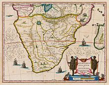
Map by Willem Janszoon Blaeu, dated 1635, showing the course of the Zambezi, and its source in a great lake.
"The River Cuama is by them called Zambeze; the head whereof is so farre within Land that none of them know it, but by tradition of their Progenitors say it comes from a Lake in the midst of the continent which yeelds also other great Rivers, divers ways visiting the Sea. They call it Zambeze, of a Nation of Cafres dwelling neere that Lake which are so called." —J. Santos Ethiopia Oriental, 1609[14]
Thus the term "Zambezi" is after a people who live by a great lake to the north. The most likely candidates are the "M'biza", or Bisa people (in older texts given as Muisa, Movisa, Abisa, Ambios and other variations), a Bantu people who live in what is now central-eastern Zambia, between the Zambezi River and Lake Bangweolo (at the time, before the Lunda invasion, the Bisa would have likely stretched further north, possibly to Lake Tanganyika). The Bisa had a reputation as great cloth traders throughout the region.[15]
In a curious note, the Goese-born Portuguese trader Manuel Caetano Pereira, who traveled to the Bisa homelands in 1796 was surprised to be shown a second, separate river referred to as the "Zambezi".[16] This "other Zambezi" that puzzled Pereira is most likely what modern sources spell the Chambeshi River in northern Zambia.
The Monomatapa notion (reported by Santos) that the Zambezi was sourced from a great internal lake might be a reference to one of the African Great Lakes. One of the names reported by early explorers for Lake Malawi was "Lake Zambre" (probably a corruption of "Zambezi"), possibly because Lake Malawi is connected to the lower Zambezi via the Shire River. The Monomatapa story resonated with the old European notion, drawn from classical antiquity, that all the great African rivers—the Nile, the Senegal, the Congo, now the Zambezi, too—were all sourced from the same great internal lake. The Portuguese were also told that the Mozambican Espirito Santo "river" (actually an estuary formed by the Umbeluzi, Matola and Tembe rivers) was sourced from a lake (hence its outlet became known as Delagoa Bay). As a result, several old maps depict the Zambezi and the "Espirito Santo" rivers converging deep in the interior, at the same lake.
However, the Bisa-derived etymology is not without dispute. In 1845, W.D. Cooley, examining Pereira's notes, concluded the term "Zambezi" derives not from the Bisa people, but rather from the Bantu term "mbege"/"mbeze" ("fish"), and consequently it probably means merely "river of fish".[17] David Livingstone, who reached the upper Zambezi in 1853, refers to it as "Zambesi" but also makes note of the local name "Leeambye" used by the Lozi people, which he says means "large river or river par excellence". Livingstone records other names for the Zambezi—Luambeji, Luambesi, Ambezi, Ojimbesi and Zambesi—applied by different peoples along its course, and asserts they "all possess a similar signification and express the native idea of this magnificent stream being the main drain of the country".[18]
In Portuguese records, the "Cuama River" term disappeared and gave way to the term "Sena River" (Rio de Sena), a reference to the Swahili (and later Portuguese) upriver trade station at Sena. In 1752, the Zambezi delta, under the name "Rivers of Sena" (Rios de Sena) formed a colonial administrative district of Portuguese Mozambique. But common usage of "Zambezi" led eventually to a royal decree in 1858 officially renaming the district "Zambézia".

Exploration of the river


Satellite image showing Victoria Falls and subsequent series of zigzagging gorges
 
The Zambezi region was known to medieval geographers as the Empire of Monomotapa, and the course of the river, as well as the position of lakes Ngami and Nyasa, were given broadly accurately in early maps. These were probably constructed from Arab information.[19]
The first European to visit the inland Zambezi river was the Portuguese degredado António Fernandes in 1511 and again in 1513, with the objective of reporting on commercial conditions and activities of the interior of Central Africa. The final report of these explorations revealed the importance of the ports of the upper Zambezi to the local trade system, in particular to East African gold trade.[20]
The first recorded exploration of the upper Zambezi was made by David Livingstone in his exploration from Bechuanaland between 1851 and 1853. Two or three years later he descended the Zambezi to its mouth and in the course of this journey found the Victoria Falls. During 1858–60, accompanied by John Kirk, Livingstone ascended the river by the Kongone mouth as far as the Falls, and also traced the course of its tributary the Shire and reached Lake Malawi.[19]
For the next 35 years very little exploration of the river took place. Portuguese explorer Serpa Pinto examined some of the western tributaries of the river and made measurements of the Victoria Falls in 1878.[19] In 1884 the Scottish-born Plymouth Brethren missionary Frederick Stanley Arnot traveled over the height of land between the watersheds of the Zambezi and the Congo, and identified the source of the Zambezi.[21] He considered that the nearby high and cool Kalene Hill was a particularly suitable place for a mission.[22] Arnot was accompanied by the Portuguese trader and army officer António da Silva Porto.[23] In 1889 the Chinde channel north of the main mouths of the river was seen. Two expeditions led by Major A. St Hill Gibbons in 1895 to 1896 and 1898 to 1900 continued the work of exploration begun by Livingstone in the upper basin and central course of the river.[19]
 
Two local people in the Zambezi river near Victoria falls, Zambia.

Economy

The population of the Zambezi river valley is estimated to be about 32 million. About 80% of the population of the valley is dependent on agriculture, and the upper river's flood plains provide good agricultural land.
Communities by the river fish it extensively, and many people travel from far afield to fish. Some Zambian towns on roads leading to the river levy unofficial 'fish taxes' on people taking Zambezi fish to other parts of the country. As well as fishing for food, game fishing is a significant activity on some parts of the river. Between Mongu and Livingstone, several safari lodges cater for tourists who want to fish for exotic species, and many also catch fish to sell to aquaria.
The river valley is rich in mineral deposits and fossil fuels, and coal mining is important in places. The dams along its length also provide employment for many people near them, in maintaining the hydroelectric power stations and the dams themselves. Several parts of the river are also very popular tourist destinations. Victoria Falls receives over 100,000 visitors annually, with 141,929 visitors reported in 2015.[24] Mana Pools and Lake Kariba also draw substantial tourist numbers.

Transport


1975 photo of Victoria Falls Bridge
 
The river is frequently interrupted by rapids and so has never been an important long-distance transport route. David Livingstone's Zambezi Expedition attempted to open up the river to navigation by paddle steamer, but was defeated by the Cahora Bassa rapids. Along some stretches, it is often more convenient to travel by canoe along the river rather than on the unimproved roads which are often in very poor condition due to being regularly submerged in flood waters, and many small villages along the banks of the river are only accessible by boat. 
In the 1930s and 40s a paddle barge service operated on the stretch between the Katombora Rapids, about 50 kilometres (31 mi) upstream from Livingstone, and the rapids just upstream from Katima Mulilo. However, depending on the water level, boats could be paddled through—Lozi paddlers, a dozen or more in a boat, could deal with most of them—or they could be pulled along the shore or carried around the rapids, and teams of oxen pulled barges 5 kilometres (3.1 mi) over land around the Ngonye Falls.[25]
Road, rail and other crossings of the river, once few and far between, are proliferating. They are, in order from the river's source:


Tourist boat on the Zambezi River, Mosi-oa-Tunya National Park, Zambia. 1971 photo.
 
  • Otto Beit Bridge at Chirundu, road, 382 metres (1,253 ft), 1939
  • Second Chirundu Bridge, road, 400 metres (1,300 ft), 2002
  • Cahora Bassa Dam is in a remote area and does not carry a highway across the river
  • Tete Suspension Bridge, 1-kilometre (1,000 m) road bridge (1970s)
  • Dona Ana Bridge, originally railway but converted to single-lane road, (1935), the longest at 3 kilometres (1.9 mi), since late 2009 it is again a railway bridge, passenger and freight trains are again running across it and from 2011 on the railway line over this bridge may convey several million of tonnes of Tete coal to the port of Beira.
  • Caia Bridge—construction started in 2007 of a 2.3-kilometre (1.4 mi) road bridge to replace the Caia ferry, which, with Kazungula, is the largest ferry across the river
There are a number of small pontoon ferries across the river in Angola, western Zambia, and Mozambique, notably between Mongu and Kalabo. Above Mongu in years following poor rainy seasons the river can be forded at one or two places. In tourist areas, such as Victoria Falls and Kariba, short-distance tourist boats take visitors along the river.

Ecology

Lake Cahora Bassa in Mozambique, one of the river's major sources of hydroelectric energy

Pollution

Sewage effluent is a major cause of water pollution around urban areas, as inadequate water treatment facilities in all the major cities of the region force them to release untreated sewage into the river. This has resulted in eutrophication of the river water and has facilitated the spread of diseases of poor hygiene such as cholera, typhus and dysentery.

Effects of dams

The construction of two major dams regulating the flow of the river has had a major effect on wildlife and human populations in the lower Zambezi region. When the Cahora Bassa Dam was completed in 1973, its managers allowed it to fill in a single flood season, going against recommendations to fill over at least two years. The drastic reduction in the flow of the river led to a 40% reduction in the coverage of mangroves, greatly increased erosion of the coastal region and a 60% reduction in the catch of prawns off the mouth due to the reduction in emplacement of silt and associate nutrients. Wetland ecosystems downstream of the dam shrank considerably. Wildlife in the delta was further threatened by uncontrolled hunting during the civil war in Mozambique.

Conservation measures

The Kavango–Zambezi Transfrontier Conservation Area will cover parts of Zambia, Angola, Namibia, Zimbabwe and Botswana, including the famous Okavango Delta in Botswana and Mosi-oa-Tunya (The Smoke That Thunders, or Victoria Falls). It is thought that the cross-border park will help with animal migration routes and assist in the preservation of wetlands which clean water, as sewage from communities is a problem.
Funding was boosted for cross-border conservation along the Zambezi in 2008. The Kavango–Zambezi Transfrontier Conservation project—which follows the Zambezi River and stretches across Angola, Botswana, Namibia, Zambia and Zimbabwe—has received a grant of €8 million from a German nongovernmental organisation. Part of the funds will be used for research in areas covered by the project. However, Angola has warned that landmines from their civil war may impede the project.[30]
The river currently passes through Ngonye Falls National Park, Mosi-oa-Tunya National Park, and Lower Zambezi National Park (in Zambia), and Zambezi National Park, Victoria Falls National Park, Matusadona National Park, Mana Pools National Park, and the Middle Zambezi Biosphere Reserve (in Zimbabwe).

Fish stocks management

As of 2017 the situation of overfishing in the upper Zambezi and its tributaries was considered dire, in part due to weak enforcement of the respective fisheries acts and regulations. The fish stocks of Lake Liambezi in the eastern Caprivi were found to be totally depleted, and surveys indicated a decline in the whole Zambezi-Kwando-Chobe river system. Illegal fishing (i.a. by foreign nationals employed by Namibians) and commercially minded individuals, exploited the resources to the detriment of local markets and the communities whose culture and economy depend on these resources.[31]
Namibian officials have consequently banned monofilament nets, and imposed a closing period of about 3 months every year to allow the fish to breed. They also appointed village fish guards and the Kayasa channel in the Impalila conservancy area was declared a fisheries reserve. The Namibian ministry also promotes aquaculture and plans to distribute thousands of fingerlings to registered small-scale fish farmers of the region.[31]

EUS outbreak

On 14 September 2007, epizootic ulcerative syndrome (EUS) killed hundreds of sore-covered fish in the river. Zambia Agriculture Minister Ben Kapita asked experts to investigate the outbreak to probe the cause to find out if the disease can be transmitted to humans.[32]

Major towns

Along much of the river's length, the population is sparse, but important towns and cities along its course include the following:

See also

References

Further reading
  • Bento C.M., Beilfuss R. (2003), Wattled Cranes, Waterbirds, and Wetland Conservation in the Zambezi Delta, Mozambique, report for the Biodiversity Foundation for Africa for the IUCN - Regional Office for Southern Africa: Zambezi Basin Wetlands Conservation and Resource Utilisation Project.
  • Bourgeois S., Kocher T., Schelander P. (2003), Case study: Zambezi river basin, ETH Seminar: Science and Politics of International Freshwater Management 2003/04
  • Davies B.R., Beilfuss R., Thoms M.C. (2000), "Cahora Bassa retrospective, 1974–1997: effects of flow regulation on the Lower Zambezi River," Verh. Internat. Verein. Limnologie, 27, 1–9
  • Dunham KM (1994), The effect of drought on the large mammal populations of Zambezi riverine woodlands, Journal of Zoology, v. 234, p. 489–526
  • Dorling Kindersley Publishing, Inc. (2004). World reference atlas. New York: Dorling Kindersley. ISBN 0-7566-0481-8
  • Wynn S. (2002), "The Zambezi River - Wilderness and Tourism", International Journal of Wilderness, 8, 34.
  • H. C. N. Ridley: “Early History of Road Transport in Northern Rhodesia”, The Northern Rhodesia Journal, Vol 2 No 5 (1954)—Re Zambezi River Transport Service at Katombora.
  • Funding boost for cross-border conservation project

External links


  • "Richard Beilfuss & David dos Santos: Patterns of Hydrological Change in the Zambezi Delta, Monogram for the Sustainable Management of Cahora Bassa Dam and The Lower Zambezi Valley (2001). Estimated mean flow rate 3424 m³/s" (PDF). Archived from the original (PDF) on 17 December 2008. Retrieved 18 October 2008.

  • International Network of Basin Organisations/Office International de L'eau: Archived 27 March 2009 at the Wayback Machine "Développer les Compétences pour mieux Gérer l'Eau: Fleuves Transfrontaliers Africains: Bilan Global." (2002). Estimated annual discharge 106 km3, equal to mean flow rate 3360 m3/s

  • "Dilapidated Zambezi Source Site Worry Ikelenge DC". muvitv.com. Muvi TV. Archived from the original on 4 September 2015. Retrieved 1 August 2015.

  • "ZM002 Source of the Zambezi". birdlife.org. Birdlife International. Retrieved 1 August 2015.

  • Dorling Kindersley, pp. 84–85

  • Knifton, Dulcie (July 2004). Revise AS Level Geography for Edexcel Specification B. Heinemann. ISBN 9780435101541.

  • "Zambezi River Delta : Image of the Day". earthobservatory.nasa.gov. 29 August 2013.

  • "Zambezian coastal flooded savanna". Terrestrial Ecoregions. World Wildlife Fund.

  • Richard Beilfuss & David dos Santos: Patterns of Hydrological Change in the Zambezi Delta, Mozambique. Archived 2 January 2008 at the Wayback Machine Working Paper No 2 Program for the Sustainable Management of Cahora Bassa Dam and The Lower Zambezi Valley (2001)

  • Goudie, A.S. (2005). "The drainage of Africa since the Cretaceous". Geomorphology. 67: 437–456.

  • Moore, A.E. (1999). "A reapprisal of epeirogenic flexure axes in southern Africa". South African Journal of Geology. 102 (4): 363–376.

  • AWF Four Corners Biodiversity Information Package No 2: Summary of Technical Reviews Archived 17 February 2012 at the Wayback Machine Accessed 1 March 2007.(dead link)

  • Barros, Da Asia, Dec. I, Lib. X, vol. 2, p.374)

  • Fr. J. dos Santos (1609), Ethiopia Oriental e varia historia de cousas Notaveis do Oriente, Pt. III. English translation is from Samuel Purchas's 1625 Haklyutus Posthumus, (1905) ed., Glasgow, vol. 10: p.220-21

  • The connection between Santos/Monomatapa "Zambezi" and the "M'biza" is suggested in Cooley (1845).

  • "Notícias dadas por Manoel Caetano Pereira, comerciante, que se entranhou pelo interior da África", as published in José Acúrsio das Neves (1830) Considerações Políticas e Comerciais sobre os Descobrimentos e Possessões na África e na Ásia. Lisbon: Imprensa Regia. p.373

  • W.D. Cooley (1845) "The Geography of N'yassi, or the Great Lake of Southern Africa, investigated, with an account of the overland route from the Quanza in Angola to the Zambezi in the government of Mozambique", Journal of the Royal Geographical Society, p.185-235.

  • David Livingstone (1857) Missionary Travels and Researches in South Africa (p.208)

  •  One or more of the preceding sentences incorporates text from a publication now in the public domainCana, Frank (1911). "Zambezi". In Chisholm, Hugh (ed.). Encyclopædia Britannica. 28 (11th ed.). Cambridge University Press. pp. 951–953.

  • Newitt, Malyn (2005). A History of Portuguese Overseas Expansion, 1400-1668. Routledge. p. 81. ISBN 0-203-32404-8.

  • Howard, Dr. J. Keir (2005). "Arnot, Frederick Stanley". Dictionary of African Christian Biography. Archived from the original on 27 September 2007. Retrieved 14 December 2011.

  • Pritchett, James Anthony (2007). Friends for life, friends for death: cohorts and consciousness among the Lunda-Ndembu. University of Virginia Press. pp. 29–31. ISBN 0-8139-2624-6.

  • Fish, Bruce; Fish, Becky Durost (2001). Angola, 1880 to the present: slavery, exploitation, and revolt. Infobase Publishing. p. 30. ISBN 0-7910-6197-3.

  • [1] Republic of Zambia Ministry of Tourism and Arts 2015 Tourism Statistical Digest

  • E. C. Mills: "Overlanding Cattle from Barotse to Angola", The Northern Rhodesia Journal, Vol 1 No 2, pp 53–63 (1950). Accessed 16 December 2017.

  • Visible on Google Earth at latitude -11.906 longitude 22.831.

  • Visible on Google Earth at longitude 22.924 latitude -15.214.

  • "Mongu-Kalabo Road - Zambia's Engineering Marvel". zedcorner.com. 13 April 2016. Retrieved 13 March 2018.

  • "President launches K108m Sioma Bridge – Zambia Daily Mail". www.daily-mail.co.zm. Retrieved 13 March 2018.

  • "Funding boost for cross-border conservation project".

  • Kooper, Lugeretzia (23 June 2017). "Zambezi fishermen warned against overfishing". namibian.com.na. The Namibian. Retrieved 24 July 2017.